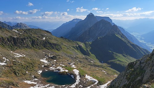
Austria 2023: Gschnitztal Hut Tour
More photos here…
Day 0: Travelled to Steinach, Austria
Flew out to Innsbruck, stayed overnight in Steinach and got a bus up to Trins (1,220m) the following morning.
Day 1: Blaserhütte (2,176m)
From Trins, picked up route 31 by the Talback then into the forest on route 11, 30. Crossed the vehicle track and continued upwards to meet it again, then followed route 11,13 close to the vehicle track to the hut. Fairly damp foggy day but we ascended Blaser (2,241m) in the afternoon and found some Edelweiss.
- 6km, 960m up, 13m down, 3hrs
- GPX Route: https://www.haroldstreet.org.uk/routes/download/?walk=6000
- Hut link: https://www.blaserhuette.at/
Day 2: Padasterjochhaus (2,232m)
Ascended Peilspitze (2,392m) on path 13 and down to Kalbenjoch (2,225m). Ascended path 7 to Kesselspitze (2,728m) and then followed the ridge path over Roter Kopf (2,526m) towards Wasenwand. We included the optional Wasenwand summit, then descended to the Padasterjochhaus.
- 6km, 953m up, 913m down, 6:30hrs
- GPX Route: https://www.haroldstreet.org.uk/routes/download/?walk=6001
- Hut link: https://www.padasterjochhaus.at/
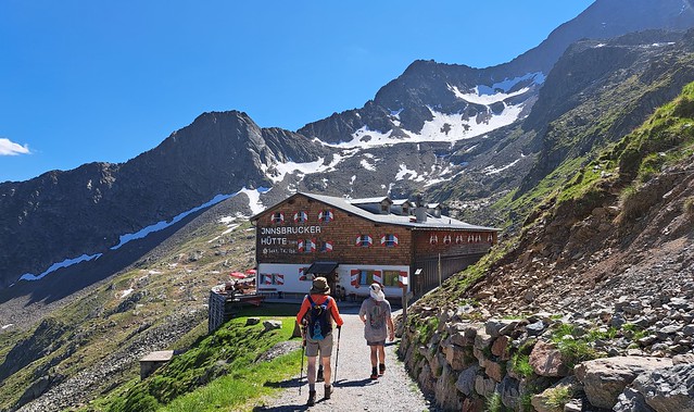
Day 3: Innsbrucker Hütte (2,369m)
Descended path 7 Herrensteig criss-crossing the vehicle track until a road bridge over the stream at 1,479m. Continued descending on track 122 and 54 into Trins. (5.8km / 1000m). Caught the bus up the Gschnitz valley to Gasthof Feuerstein (stopped for lunch). Ascended path 60 to Innsbrucker Hutte (4.2km / 1100m) using their seilbahn for heavy rucksacks.
- 22.3km (9 by bus), 1210m up, 1132m down, 7hrs.
- GPX Route: https://www.haroldstreet.org.uk/routes/download/?walk=6002
- Hut Link: https://innsbrucker-huette.at/
Day 4: Bremer Hütte (2,413m)
Followed route 124. Lots of up and downs and protected sections. At the junction with the path from Lautersee, we descended to cross the stream and ascended a ladder section to reach the main valley path a short distance before the hut. This is a route we previously did in reverse as part of the Stubai Hut to Hut trip in 2003.
- 10.3km, 877m up, 807m down, 7hrs
- GPX Route: https://www.haroldstreet.org.uk/routes/download/?walk=6003
- Hut link: https://www.bremerhuette.at/
Day 5: Tribulaunhütte (2,064m)
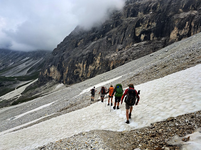
Took path 102 heading down, and branched off to cross the bridge over the Simmingbach. The route contoured round to a ladder before crossing meadows on the Jubiläumssteig to the Schwarze Wand. We then ascended over rough boulders / meadow to the Sandesjochl (2,550m), close to the Pflescher Scharte. From here we descended on scree path 61, 130 and then 63 (Dolomieu Weg) to contour around the cirque under the Gschnitzer Tribulaun to the Austrian Tribulaunhutte (not the nearby Italian one).
- 10.4km, 716m up, 1105m down, 6:30hr
- GPX Route: https://www.haroldstreet.org.uk/routes/download/?walk=6004
- Hut Link: https://www.tribulaunhuette.at/
Day 6: Nosslachjoch (2,080m)
Ascended steep path, 127, to Gstreinjochl (2,540m). Continued through rocky landscape on path 127 to Vordere Wildgruße, then path 94 to Trunajoch, then path 42 (Lichtseeweg) to Eggerjoch (2,132m). From here we took path 42 and then 41 to Nosslachjoch and the gondola station. We then descended to Bergeralm (middle station) and caught the gondola to descend to the bottom station in Steinach. Rained most of the day so no photos here.
- 14km, 688m up, 845m down, 7hrs
- GPS Route: https://www.haroldstreet.org.uk/routes/download/?walk=6005
We then went to Kals for week 2…
Useful Links…
- https://www.wipptal.at/en/experience-the-wipptal/summer/hiking/gschnitztal-hut-tour/
- https://www.tyrol.com/things-to-do/sports/hiking/hiking-tours/a-gschnitztaler-huettentour
Author: Phil Newby


Leave a Reply