Skip to content

Phil's Hiking Resources

Keyword: GPS

GPSU  

GPSU, is an excellent and affordable (c.a. £20) resource allowing management of waypoints, routes and trackpoints against a digital map background. Its the one I tend to use most as it has the major advantage of being able to hold more than 500 waypoints at one time. As its shareware there is also a limited free » read more »

Magellan 315 DIY Data Cable  

How to make your own Data Transfer cable. This is quite easy to make, works well and is much cheaper than the one from Magellan. For a different example see: http://www.kolumbus.fi/ari.torpstrom/mag315.htm It is in Finnish but the pictures are self explanatory.

MagWay  

Mag-Way; a good basic free waypoint editor for Magellan GPS units, with the advantage of being able to convert travel information into routes / waypoints with a little bit of extra free software.

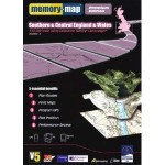
Memory Map v 5  

I use Memory Map v.5 – and find it preferable to Anquet. It handles GPX files well (imports & exports). Has excellent UK map coverage at 1:50,000, 1:25,000 and a range of areas of particular interest – e.g Munros, Snowdonia, Lake District etc… To be honest i rarely use it directly with my GPS, but » read more »

OziExplorer  

Ozi-Explorer is a professional but more expensive (c.a. $65) resource allowing management of waypoints, routes and trackpoints against a digital map background. As its shareware there is also a limited free trial version. www.oziexplorer.com


Author: Phil Newby