lakes-
Fours - The 400m Hills of England comprise all English hills 400m and above and below 500m in height that have 30m minimum drop. There are 298 qualifying hills that cover the length of the country from the Cheviot Hills in the north, to Bodmin Moor in the south-west. The list is authored by Myrddyn Phillips and Aled Williams.
Further details at Mapping Mountains Publications
Members can use the list below as their personal Four bagging tick list. Just register and log in to tick them off...
Data courtesy of Myrddyn Phillips and Aled Williams
Selected mapping: Google or Bing / Ordnance Survey
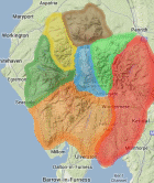
Map Legend: :Fours
Four List & GPS Waypoints:
Climbed any of these hills? Log in to tick them off...
Sort this list by: Name | Height | Popularity | Prominence | Significance
- '0433.w' NY393149 Arnison Crag (434m, p32.1)
- '0471.-' NY562027 Ashstead Fell (471m, p40.1)
- '0456.b' NY116174 Banna Fell (455m, p38)
- '0469.w' NY214267 Barf (469m, p37.5)
- '0455.w' NY227218 Barrow (455m, p70.6)
- '0487.w' NY403051 Baystones (487m, p147.5)
- '0447.W' NY225355 Binsey (447m, p242.3)
- '0417.w' NY264162 Brund Fell (417m, p42.4)
- '0478.-' NY570014 Castle Fell (479m, p70.3)
- '0451.w' NY244198 Catbells (452m, p87.6)
- '0455.s' NY381225 Cockley Moor (455m, p38.1)
- '0454.b' NY169230 Dodd (453m, p39.2)
- '0420.s' NY268171 Ether Knott (420m, p97.7)
- '0416.w' NY132242 Fellbarrow (416m, p51.5)
- '0442.w' NY380175 Glenridding Dodd (443m, p44.7)
- '0481.p' NY407217 Gowbarrow Fell (481m, p100.1)
- '0494.P' SD598998 Grayrigg Forest (494m, p188.9)
- '0455.b' NY177264 Graystones (455m, p77.8)
- '0449.w' NY269146 Great Crag (449m, p33.6)
- '0437.b' NY414223 Great Meldrum (438m, p41.4)
- '0427.b' SD194968 Great Worm Crag (428m, p35)
- '0489.w' SD200982 Green Crag (489m, p142.4)
- '0488.w' NY084140 Grike (487m, p36)
- '0405.w' NY326093 Helm Crag (404m, p71)
- '0478.b' SD176946 Hesk Fell (478m, p98.7)
- '0495.b' NY543048 High House Bank (496m, p80.2)
- '0426.b' NY469040 Hollow Moor (426m, p77.7)
- '0408.b' NY302021 Hull How (407m, p46.8)
- '0402.s' NY266143 Knotts (402m, p40)
- '0411.s' SD249942 Lag Bank (411m, p30.3)
- '0470.W' NY302046 Lingmoor Fell (470m, p248.2)
- '0493.b' NY515052 Long Crag (493m, p33.1)
- '0452.s' NY557085 Long Fell (454m, p44.6)
- '0483.w' NY275353 Longlands Fell (482m, p36)
- '0423.W' NY137226 Low Fell (423m, p266.6)
- '0482.-' NY565022 Mabbin Crag (482m, p97.3)
- '0446.b' NY094190 Murton Fell (446m, p140)
- '0416.s' NY302052 Oakhow Crag (416m, p30.3)
- '0469.b' SD237947 Pikes (468m, p42.9)
- '0424.b' NY424233 Pt. 422.3m (422m, p37.5)
- '0485.-' NY558045 Pt. 484.6m (485m, p80.2)
- '0489.b' NY487164 Pt. 489.0m (489m, p36.6)
- '0461.w' NY303187 Raven Crag (461m, p43.3)
- '0492.b' NY530058 Robin Hood (492m, p30)
- '0429.s' NY487015 Sleddale Forest (429m, p115.9)
- '0483.w' NY427032 Sour Hows (482m, p34.2)
- '0411.b' NY134233 Sourfoot Fell (412m, p35.1)
- '0432.w' NY440181 Steel Knotts (432m, p52.5)
- '0447.b' NY220219 Stile End (448m, p34.6)
- '0446.b' NY302193 The Benn (446m, p50.6)
- '0469.b' SD200987 The Pike (469m, p54.7)
- '0404.b' NY227043 Throstlehow Crag (403m, p37.1)
- '0484.b' NY394041 Wansfell Pike (484m, p30.8)
- '0490.b' NY541061 Whatshaw Common (490m, p69.9)
- '0471.-' NY570037 Whinash (471m, p40.3)
- '0472.-' NY573002 Whinfell Beacon (471m, p78.5)
- '0444.b' SD205974 White How (444m, p30.9)
- '0499.b' NY231030 Yew Bank (499m, p31.4)
- '0494.b' SD156952 Yoadcastle (494m, p58)
All these waypoints have been bagged by...
alan caine amblerbob Chris Pearson chrisd101 dave geere iwc jonglew moorsman nordicstar oakesave Peebs rhw Ronnie Bowron snaithd Wanderer Wycombe Wanderer
Total = 59 Fours in Lake District
Data courtesy of Myrddyn Phillips and Aled Williams
