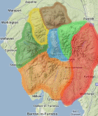
Area: NORTHERN FELLS -
TumpBeags - hills in Britain & Ireland with 15m-19.9m prominence irrespective of height.
The list has been compiled by Bernie Hughes, and includes data originated by Myrddyn Phillips and Aled Williams. Source lists available at
The Welsh P15s, The Fours and The Welsh Highlands - Uchafion Cymru. Thanks also to
https://MountainViews.ie/ for permssion to include data from their Arderin Begs list.
Members can use the list below as their personal TumpBeag bagging tick list. Just register and log in to tick them off...
Selected mapping: Google or Bing / Ordnance Survey
Map Legend: :TumpBeags | :Nearby TumpBeags
TumpBeag List & GPS Waypoints:
Climbed any of these hills? Log in to tick them off...
Sort this list by: Name | Height | Popularity | Prominence | Significance
- '0845.n' NY324283 Atkinson Pike (Foule Crag) (845m, p16)
- '0309.-' NY406282 Bonfire Hill (309m, p17.9)
- '0030.-' NY274575 Fingland Rigg (30m, p19.7)
- '0852.n' NY317273 Gategill Fell Top (852m, p18.1)
- '0616.N' NY310339 Great Lingy Hill (616m, p18)
- '0292.-' NY423290 Greystoke Moor (292m, p19.3)
- '0627.n' NY315343 Hare Stones (627m, p16)
- '0610.n' NY303338 Miller Moss (Little Lingy Hill) (610m, p19.8)
- '0607.b' NY329341 Miton Hill (607m, p14)
- '0666.n' NY276286 Sale How (666m, p18)
- '0519.s' NY351287 Souther Fell South Top (519m, p15)
Total = 11 TumpBeags in OS Area NORTHERN FELLS
