Hill Trigpoint List & GPS Waypoints:
Climbed any of these hills? Log in to tick them off...
Sort this list by: Name | Height | Popularity | Prominence | Significance
- '0311.-' SD245804 Bank House Moor (311m, p48)
- '0136.-' SD283742 Birkrigg Common (136m, p71)
- '0600.B' SD135854 Black Combe (600m, p361)
- '0323.w' NY340015 Black Fell (323m, p126)
- '0298.p' SD260858 Burney (298m, p112)
- '0314.b' SD325943 Carron Crag (314m, p74)
- '0529.b' SD230944 Caw (529m, p136)
- '0270.P' SD382973 Claife Heights (270m, p176)
- '0063.-' SD215862 Coal Gate Bank (63m, p45)
- '0096.-' SD111905 Corney Hill (96m, p16.5)
- '0026.-' SD084976 Cumblands (26m, p15.1)
- '0305.b' SD211915 Great Stickle (305m, p26)
- '0653.H' SD218997 Harter Fell (Eskdale) (653m, p273)
- '0156.-' SD226761 High Haume Beacon (156m, p53)
- '0281.-' SD174872 Knott Hill (281m, p75)
- '0231.-' SD112983 Muncaster Fell-Hooker Crag (231m, p30.2)
- '0978.H' NY215072 Scafell Pike (978m, p912)
- '0068.-' NY077022 Stubshead Hill (68m, p19.5)
- '0163.-' SD297808 The Alps (163m, p57)
- '0802.H' SD272978 The Old Man of Coniston (Coniston Old Man) (802m, p417)
- '0573.B' SD158929 Whitfell (573m, p223)
All these waypoints have been bagged by...
alan caine Carole clochandighter jonglew Matt murphy nordicstar painterman PeteBoggs rhw
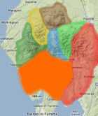
Total = 21 Hill Trigpoints in OS Area SOUTHERN FELLS